
International
Typhoon Dolphin Injures Six in Japan as China Closes Ports

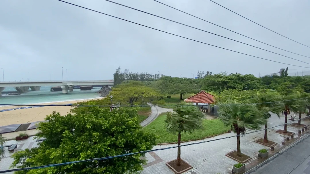
Japan’s southern islands have been hit by powerful winds and heavy rain, while China has closed ports, suspended ferry services and stepped up emergency preparations ahead of the typhoon’s expected arrival on the eastern coast.
Typhoon Dolphin has swept across Japan’s southern Okinawa prefecture, injuring at least six people and knocking out electricity to more than 50,000 buildings, as authorities in China race to protect coastal communities and infrastructure before the storm makes landfall.
The powerful storm brought sustained winds of about 162 km/h, with gusts reaching 216 km/h, disrupting air and sea travel and prompting authorities across the region to take emergency measures.
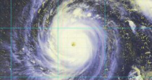
Dolphin lashed Okinawa on Saturday after moving through Japan’s southern island chain, bringing dangerous winds and heavy rain.
Five elderly people in Okinawa suffered non-life-threatening injuries, with three reportedly falling because of the strong winds. Another person was injured in neighbouring Kagoshima prefecture, according to authorities.
Power outages were widespread. Nearly 39,000 buildings in Kagoshima and more than 12,000 in Okinawa were without electricity, according to the latest reports, putting the combined number of affected buildings above 50,000.
The storm also disrupted air travel, with Japanese carriers cancelling flights to and from affected areas. The cancellations came after Japanese authorities had already ordered evacuations for hundreds of thousands of residents in parts of Okinawa and Kagoshima as the storm approached.
The next major threat is China.
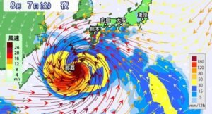
The country’s National Meteorological Centre expects Dolphin to reach China’s eastern coast between late Sunday and early Monday, with the most likely landfall area between Zhoushan in Zhejiang province and Fuding in Fujian province.
China has classified Dolphin as an orange-category typhoon, the country’s second-highest warning level, while raising its emergency response to Level III because of the threat of flooding and landslides.
Forecasts indicate winds of approximately 85–101 mph (137–163 km/h) near the storm’s centre as it approaches the coast.
The storm’s effects are expected to extend well beyond the immediate landfall zone, with heavy rain and powerful winds forecast across eastern China through August 12.
Parts of eastern Zhejiang could receive more than 600 millimetres of rainfall, raising concerns about flash flooding, river flooding and landslides.
The Associated Press reported that forecasters were expecting 200–400 mm of rain in some areas of Zhejiang, northern Fujian and Shanghai, further increasing the risk of flooding.

China has moved quickly to protect its maritime infrastructure.
Zhejiang authorities raised the coastal typhoon alert to the highest level and halted port operations. Fishing boats have been ordered back to port, while ferry services have been suspended in several areas.
In Ningbo, authorities shut schools and educational facilities for the weekend, while around 800 ships were reportedly docked at the port as a precaution.
Shanghai’s Yangshan port was cleared of vessels before the storm’s arrival, while some railway services in the Yangtze River Delta are also expected to be suspended.
The measures are particularly important because the region contains some of China’s busiest ports and industrial centres. Prolonged disruption could affect cargo movement, manufacturing supply chains and domestic transportation.
The storm has also created significant disruption to aviation.
Ningbo Lishe International Airport in Zhejiang is scheduled to suspend flights on Sunday, while airlines across the region have cancelled or adjusted services because of dangerous weather conditions.
Taiwan has also been affected. Authorities said 78 flights, mostly international, had been cancelled because of Dolphin, while heavy rain was expected in northern parts of the island.
The disruption comes as the storm moves through one of Asia’s busiest aviation and maritime corridors.
Dolphin is also creating an unusual political complication.
China has ordered vessels passing through the Taiwan Strait to follow traffic-control instructions because of the typhoon.
Taipei has strongly rejected the move, describing the order as “ridiculous” and arguing that Beijing has no authority to restrict access to international waters. Taiwan’s Coast Guard has urged ships to report any Chinese broadcast demands they receive.
The disagreement adds a geopolitical dimension to what would otherwise be a major regional weather emergency.
Beijing claims sovereignty over Taiwan and the Taiwan Strait, while Taiwan rejects China’s sovereignty claim. The United States and Taiwan have also rejected Beijing’s claim to control the strategically important waterway.
China’s preparations extend beyond coastal areas.
Officials are particularly concerned about the combination of strong winds and prolonged rainfall. In mountainous and hilly areas, saturated ground can increase the danger of landslides, while heavy rainfall can overwhelm drainage systems and rivers.
Beijing authorities have also said they are monitoring Dolphin’s path and preparing flood-control and evacuation plans, even though the capital is far from the storm’s expected landfall zone.
The storm’s projected path means eastern coastal provinces and major urban centres must prepare for several days of potentially hazardous weather rather than a brief period of disruption.
The impact of Dolphin is already being felt across a wide area.
In Japan, the storm has caused injuries, blackouts, flight cancellations and evacuation measures. In China, authorities have closed ports, suspended ferries, restricted transport and prepared for potentially severe flooding.
Taiwan is dealing with flight cancellations and heavy rainfall, while maritime traffic through the Taiwan Strait has become entangled in an increasingly sensitive dispute between Taipei and Beijing.
The immediate priority for authorities is protecting lives and infrastructure as Dolphin approaches China’s coastline.
With landfall expected between Sunday and early Monday, emergency agencies are likely to continue adjusting evacuation, transport and port restrictions depending on the storm’s speed, strength and precise trajectory.
For coastal communities in Zhejiang and Fujian, the greatest risks in the coming days will be damaging winds, torrential rainfall, flooding, landslides and dangerous seas.