
General News
UN Backs Africa’s Push to ‘Correct the Map’, 164 Countries Reject Mercator Distortion

The United Nations General Assembly has overwhelmingly backed an African-led campaign to change how the world is represented on maps, endorsing a new projection that more accurately reflects Africa’s enormous landmass.
The resolution, championed by Togo on behalf of the African Group and supported by the African Union, was adopted on Friday by 164 votes to one, with six countries abstaining. The United States was the only country to vote against the measure.
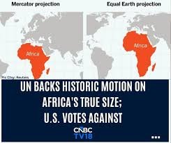
The move marks a significant victory for the “Correct the Map” campaign, which challenges the continued dominance of the 16th-century Mercator projection in classrooms, official documents, media and digital platforms.
Supporters argue that the Mercator projection, while originally designed for navigation, dramatically distorts the relative size of land masses, making countries and regions near the poles appear much larger while shrinking areas around the equator.
Africa is one of the biggest casualties of the distortion.
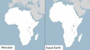
On the Mercator map, Africa can appear roughly comparable in size to Greenland. In reality, Africa is about 14 times larger than Greenland.
Africa demands a more accurate picture
Togo led the campaign after the African Union endorsed the initiative, arguing that maps do more than show geography — they influence how generations understand the world and their place in it.
Togo’s Foreign Minister, Robert Dussey, described the issue as a matter of scientific accuracy rather than politics, saying that the persistent use of distorted projections has contributed to the symbolic minimisation of Africa.
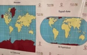
The African Union welcomed the UN vote, describing it as an important step towards ensuring that Africa and other regions are represented according to objective and scientifically established realities.
“Africa must be represented as it truly is: in its true dimensions and in its rightful place in the world,” the African Union Commission said.
The resolution promotes the Equal Earth projection, developed in 2018, as an alternative capable of showing the relative surface areas of continents more accurately.
What changes now?
The UN resolution does not legally prohibit the Mercator projection.
Instead, it encourages governments, international organisations, educational institutions, publishers and digital platforms to progressively adopt more accurate representations, particularly the Equal Earth projection.
Mercator is also expected to remain useful for specialised purposes such as maritime navigation because of the way it preserves directions and angles.
But its dominance in general-purpose maps could begin to decline.
Togo has said it intends to change its own school geography materials by the end of 2026 and plans to engage other African governments, international organisations and technology companies involved in mapping and location services.
US stands alone in opposing the resolution
The United States was the sole country to vote against the resolution.
Washington argued that the initiative promoted what it regarded as an ideological agenda and distracted attention from more pressing international challenges.
Six countries — Serbia, Estonia, Georgia, Lithuania, Moldova and Ukraine — abstained.
Despite the US opposition, the overwhelming vote gives the African-led initiative significant international backing.
For Africa, the campaign goes beyond changing the appearance of a classroom map.
It represents an attempt to challenge historical narratives and perceptions shaped by centuries of unequal representation and to ensure that the continent’s geographic, demographic, economic and geopolitical significance is reflected more accurately.
As the African Union put it following the vote, correcting the map is ultimately about ensuring that Africa is seen “in its true dimensions and in its rightful place in the world.”