General News
UN Votes to Correct Centuries-Old Map Distortion That Shrank Africa

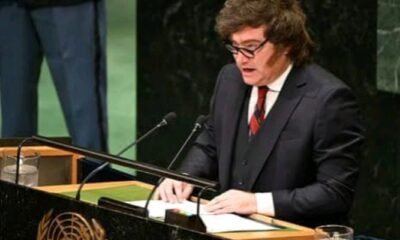
The United Nations General Assembly has passed a landmark resolution to promote a new world map that accurately depicts the true size of Africa, finally correcting a 450-year-old cartographic distortion.
The vote, which took place on September 4, 2026, saw 164 nations in favor, with only the United States voting against and six countries abstaining.
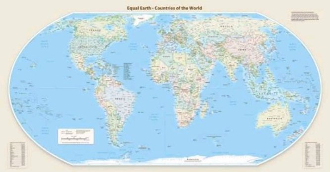
The resolution, sponsored by Togo and backed by the African Union, encourages governments, schools, and international organizations to adopt the “Equal Earth” projection.
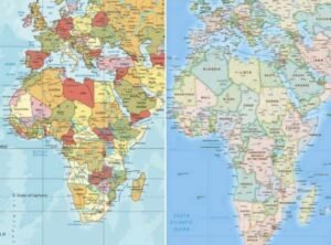
This modern map replaces the 16th-century Mercator projection, which was designed for nautical navigation and severely distorts landmasses near the poles.
The distortion is most striking when comparing Africa to Greenland; the Mercator map makes them look roughly the same size, even though Africa is actually about 14 times larger.
Togo’s Foreign Minister, Robert Dussey, who spearheaded the initiative, framed the vote as a matter of global fairness. “A fair world starts with a fair map,” he told Reuters prior to the vote.
He further stated that the resolution is about changing perceptions, noting that “a fair map does not change the geography of the world, it changes how we see the world”.
The campaign is part of a broader effort by the African Union to confront colonial legacies and challenge the visual bias that has long minimized the continent’s place in the global imagination.
The resolution is not legally binding and does not prohibit using the Mercator projection for navigation, where it remains highly effective. However, it adds significant political weight to efforts aimed at classrooms and digital platforms.
Togo has already announced plans to update its own school geography materials by the end of the year. France, a co-sponsor of the resolution, has also declared it will abandon the Mercator projection.
The lone dissenting vote came from the United States, which argued the resolution promoted an “ideological agenda” and distracted from pressing global issues.
A U.S. representative reportedly stated the debate on the 16th-century map is an example of why the U.N. is losing credibility.
Despite this opposition, the African Union hailed the vote as a historic step, emphasizing that it will help ensure world maps reflect Africa’s true “scale, weight, and place in the world”.